
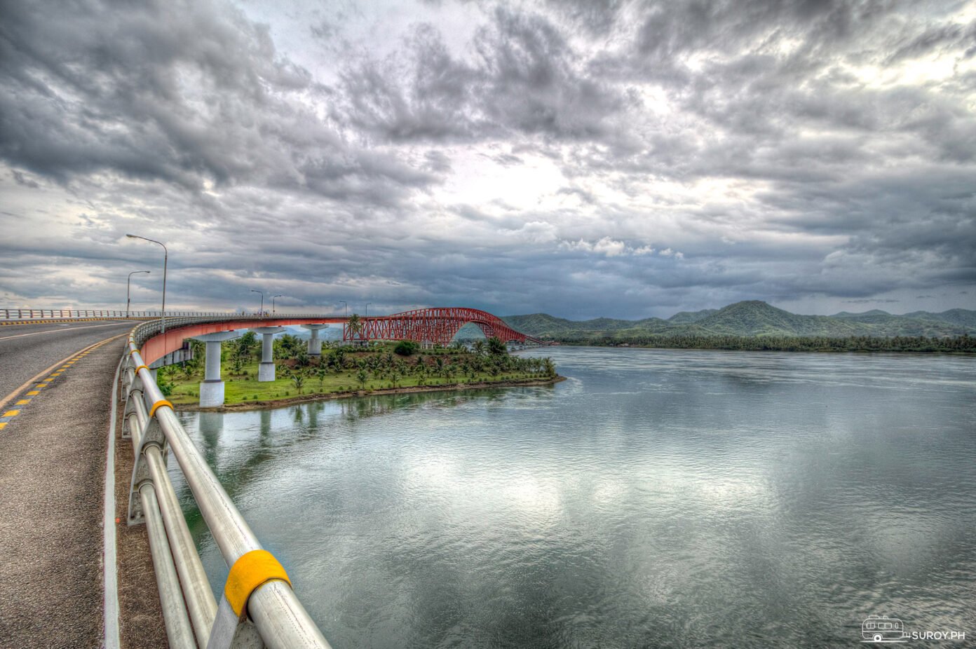

San Juanico Bridge: The S-Curve Between Samar and Leyte
Two islands stitched together by 2.16 kilometers of steel. Cross it at golden hour and stop at the viewing points.
The San Juanico Bridge is the most beautiful stretch of the Pan-Philippine Highway: 2.16 kilometers of steel drawing an S-curve across the San Juanico Strait, connecting Samar to Leyte since 1973. For decades it was the longest bridge in the Philippines, a title it only surrendered to Cebu’s CCLEX.
The verdict: do not just drive across it. Time your crossing for sunrise or sunset, stop at the viewing points, and give the strait ten minutes of your full attention. The bridge is the destination, not the detour.

Why the San Juanico Bridge matters
Completed in 1973 at Sta. Rita, Samar, the bridge did something no ferry schedule ever could: it made Samar and Leyte one continuous road. Trade, travel, and daily life across the two islands run over this span, and the region’s growth has leaned on it for fifty years. The strait below was also a strategic point in World War II, contested by Japanese and Allied forces, which gives the crossing a weight you can feel if you know to look for it.
The engineering, briefly
Two things define the design. The famous S-curve is not a flourish; it follows the strait’s geography. And the arch-shaped truss does the quiet work, distributing load so the bridge can span long distances without losing stability. Form and function in one silhouette, which is why every photo of it looks deliberate.

The bridge is mid rehabilitation, and it changes the drive
A structural assessment in 2025 found the fifty year old truss carrying more than it safely should, and the crossing has been under a weight restriction ever since. The bridge is open and a car goes over it normally. Anything heavier than a car needs checking before you commit to the route.
| 15 May 2025 | Limit cut to 3 tons and 3 meters of height by the DPWH in Eastern Visayas. Buses, cargo trucks and tricycles barred. Vehicles crossed one at a time along the centreline. |
| May 2025 | Roll on roll off ferries brought in as the stopgap for heavy vehicles, Catbalogan and Calbayog to Tacloban. |
| 12 December 2025 | Limit raised to 15 tons and two way traffic restored. The retrofit was put at ₱1.1 billion. |
| Now | 15 tons, two way, with portal shoring holding the span while the permanent retrofit is carried out. |
| Target | The original 33 tons, two way, by October 2026. |
In practice: a private car, a van or a motorbike crosses without any of this touching you. A camper, a loaded pickup or a hired truck gets weighed first. Bus routings between Tacloban and Samar have been moved on and off the ferries more than once in the past year, so if you are traveling by public transport, confirm the routing when you book rather than at the terminal.
One thing we could not confirm, and would rather say so than guess: whether stopping at the viewing points and walking out onto the span are being policed differently while the shoring is up. Nothing published says they are closed and nothing says they are open. Expect to be waved along if crews are working, and have a second composition in mind from the approach on either side.
Crossing it well
Designated viewing points along the bridge are built for exactly this, works permitting: clear water, green banks, and the truss receding in both directions. Golden hour is the honest recommendation. Sunrise if you are coming from Tacloban, sunset if you are headed there.
Make a trip of it
- Tacloban City, a short drive from the Leyte end: the Santo Niño Shrine and Heritage Museum, the Leyte Provincial Capitol, and the MacArthur Landing Memorial.
- Sohoton Natural Bridge National Park in Samar: limestone formations, caves, and a bridge nature built itself.
- Kalanggaman Island off Leyte: white sand, clear water, and some of the region’s best snorkeling.
- Basey Church in Samar, for the heritage-minded.
Quick answers
How long is the San Juanico Bridge?
2.16 kilometers, about 1.34 miles, across the San Juanico Strait.
Is San Juanico still the longest bridge in the Philippines?
No. It held the title from 1973 until CCLEX in Cebu overtook it, but it remains the most iconic crossing in the country.
Can you still cross the San Juanico Bridge in 2026?
Yes. It is open to two way traffic with a 15 ton weight limit while the retrofit continues, so cars, vans and motorbikes are unaffected. The limit was 3 tons through most of 2025 and the original 33 tons is targeted for October 2026. Checked 26 August 2026.
What connects the San Juanico Bridge?
Samar (at Sta. Rita) and Leyte, as part of the Pan-Philippine Highway.
Suroy Wear

Two islands, one road.
The bridge made Samar and Leyte one continuous drive in 1973. The Leyte Tee carries the island on the far side of it. ₱999.
Wear the story