

Agas-Agas Bridge: 89 Meters of Air and the Road That Kept Sliding Away
Eighty nine meters of air under the deck, 350 meters of concrete across it, and a zipline that stopped selling tickets in 2014. What the tallest bridge in the Philippines is actually like to stop at. Checked 25 August 2026.
AGAS-AGAS BRIDGE, SOGOD · 10.4972° N, 124.9979° E
The stretch of the Pan-Philippine Highway between Mahaplag and Sogod used to move. Rain came down the slope, the slope came down with it, and the only overland road into Southern Leyte would sit closed for days while crews dug it back out. Agas-Agas is the Bisaya name for the ground doing exactly that, and the barangay it happens in is called Kahupian.
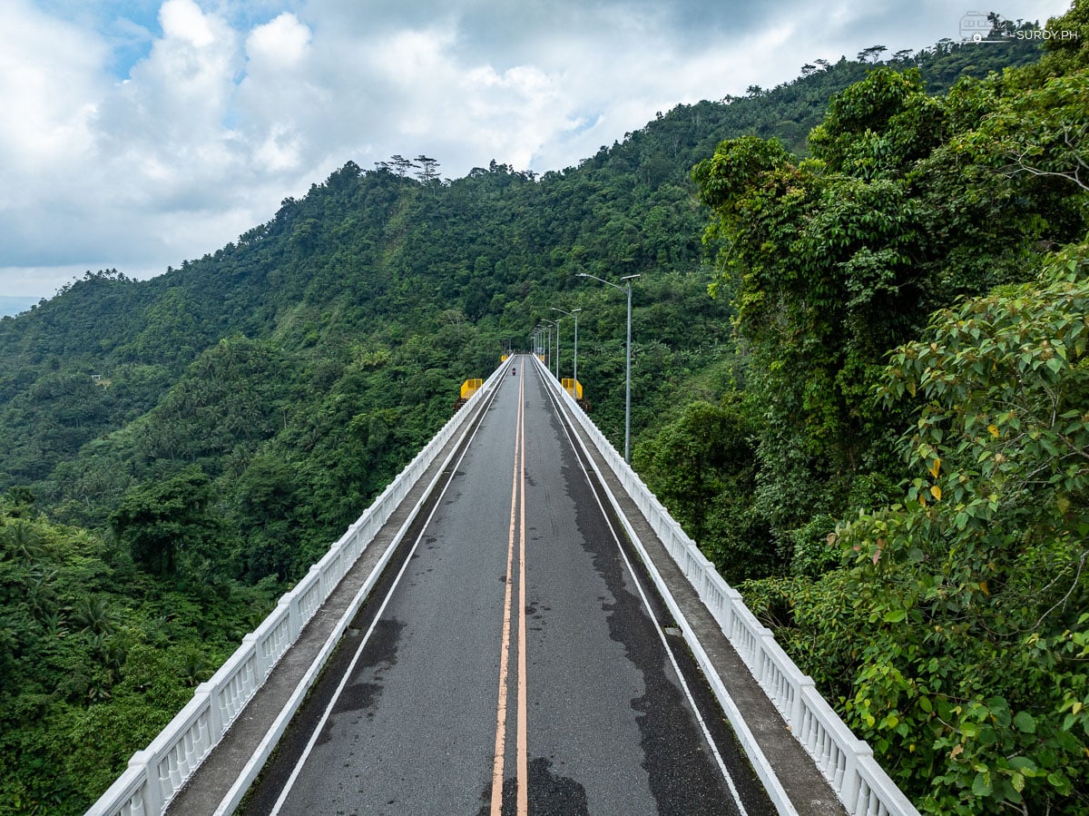
The fix was to stop arguing with the hillside and go over the top of it. The Agas-Agas Bridge carries the highway 89 meters above the ravine floor, which makes it the tallest bridge in the country, and it is tall for a reason that has nothing to do with the view. Most people cross it at sixty on a bus to Maasin and never look up from their phone.
Why the deck sits 89 meters up
A landslide corridor gives you two options. You keep rebuilding the road at the bottom of it, which is what the Maharlika did for decades, or you jump the whole unstable section in one go and land on rock at each end. Agas-Agas is the second answer. Two piers, 73 meters and 75 meters out of the ground, carry a 177 meter center span across the gap, and the height is simply where the good ground happened to be.
It cost ₱1.024 billion, funded in part by the Japan International Cooperation Agency, and it was built by Sumitomo Mitsui Construction. Work started on 17 November 2006, finished on 2 August 2009, and the bridge was inaugurated on 9 August 2009. That timeline matters because almost every page about this bridge says it was completed in 2006. It was not. 2006 is when the digging started.
The numbers, off the marker at the roadside
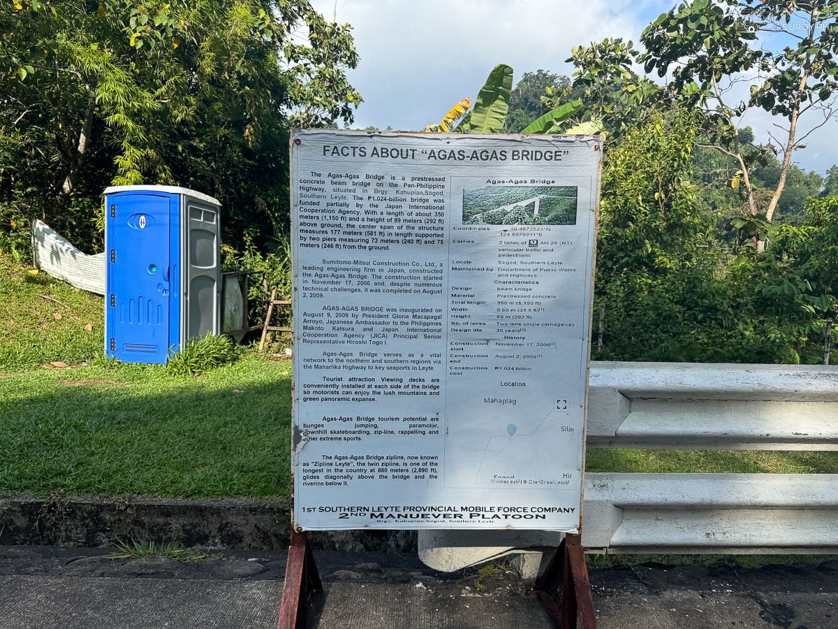
There is a Department of Public Works and Highways information board bolted to the rail at the northern end, and it settles most of the arguments that circulate online. These figures are read straight off it.
| Height above ground | 89 m (292 ft) |
| Total length | 350 m (1,150 ft) |
| Center span | 177 m (581 ft) |
| Piers | 73 m and 75 m from the ground |
| Deck width | 9.60 m, two lanes, single carriageway |
| Type | Prestressed concrete beam bridge |
| Carries | Asian Highway 26 (N1), vehicles and pedestrians |
| Location | Barangay Kahupian, Sogod, Southern Leyte |
| Built | 17 November 2006 to 2 August 2009 |
| Cost | ₱1.024 billion, partly JICA funded |
| Design life | 30 years |
| Toll | None |
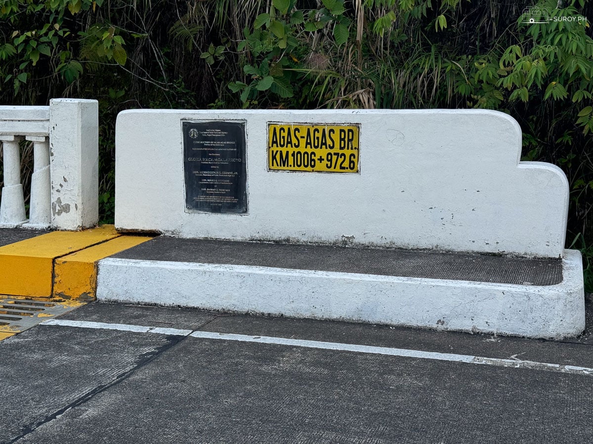
One number worth correcting while you are here. The bridge is 350 meters end to end, not the 400 that gets repeated in most write ups. The 400 is somebody rounding up a figure they had already rounded up once. And if you want to know exactly where you are standing, the nameplate on the parapet reads AGAS-AGAS BR. KM 1006 + 972.6.
Tallest is not longest, and the difference is the whole point
Three Philippine bridges get called the biggest and they are each biggest at something different. CCLEX in Cebu is the longest at 8.9 kilometers, and its pylons are far taller than anything here, but its deck sits low over water. San Juanico is the famous one, 2.16 kilometers of S curve between Samar and Leyte, and again the deck is a modest height above the strait.
Agas-Agas is short and high. At 350 meters you could walk it in five minutes. What you cannot do anywhere else in the country is stand on a public road with 89 meters of nothing directly beneath your feet. That is the reason to stop, and it is a different sensation entirely from crossing water.
The zipline, and what actually happened to it
This is the thing most people are searching for, so here it is plainly. The zipline is not running, and it has not been running for a long time.
It was real, and it was serious. Zipline Leyte opened in April 2011: a twin cable strung 880 meters diagonally over the bridge and the ravine, one of the longest and by some distance the highest in the country. Two lines meant you could race someone. A habal-habal brought you back up to the top.
The operator lost its business license in October 2014 and the cable stopped carrying passengers. Since then there has been no dated, first hand account of anyone riding it. Visitors who turn up asking are told by the vendors at the pull off that it is closed, and have been told that for over a decade.
What keeps the confusion alive is the DPWH marker itself, which still describes the zipline in the present tense, and a run of travel pages that describe the bridge as an extreme sports park about to open. Bungee jumping, paramotor, rappelling and downhill skateboarding were all approved on paper back in 2009. None of them exists on the ground.
So do not build a day around it. Come for the bridge, and treat anything else as a bonus. If it genuinely matters to your trip, phone the Kahupian barangay office on 0905 925 2523 before you set out and ask what is running that week. Status checked 25 August 2026.
What is actually there when you stop
A viewing deck at each end of the bridge, put there so drivers could pull over instead of stopping in a live traffic lane. A parking area. A portable toilet. A few kiosks that open when there is enough passing traffic to bother. The bridge name laid out in white letters across the grass embankment, which is the photo everybody takes.
Nothing costs anything. There is no entrance fee, no toll, no ticket, and nobody collecting at a gate.
The honest verdict is that this is a twenty minute stop, not a half day. Walk out along the deck, look over the rail, feel your stomach react to the drop, take the photograph, get back in the van. That is the whole visit and it is worth the pull off. Anyone planning three hours here will be sitting in a parking lot for two and a half of them.
How to get to Agas-Agas Bridge
The bridge is on the national highway, which means you do not really travel to it so much as travel through it. Any bus or van running between Tacloban and Maasin crosses it. Tell the driver you want to get off at Agas-Agas and he will know exactly where you mean.
| From | How | Time | Fare |
|---|---|---|---|
| Tacloban | Duptours bus to Maasin, hourly 06:00 to 17:00 from the New Transport Terminal | About 2 hours 30 to the bridge, 4 to Maasin | ₱370 to Maasin |
| Maasin City | Any Tacloban or Sogod bound bus or van, north on the Maharlika | About 1 hour 30 minutes | Around ₱100 |
| Sogod town | Habal-habal or tricycle, negotiated return trip | About 30 minutes | Agree the price before you get on |
| Cebu City | OceanJet fastcraft to Maasin, 07:00 daily, then north by road | 3 hours by sea, then 1 hour 30 | ₱1,320 tourist, ₱1,920 business |
Driving yourself is the better option if you have the choice, because a public bus will not wait while you walk out onto the deck. Coming from the north you will climb out of Mahaplag through a series of switchbacks and the bridge appears around a bend with no warning at all.
The road still behaves like a landslide corridor
Worth understanding before you plan around it. The bridge itself is the stable part of this route. It is the approaches either side, the switchbacks through the hills the bridge was built to skip, where the highway gets blocked in heavy rain. In a serious storm the closure will not be at the bridge, it will be a few kilometers from it, which is small comfort when you are the one waiting.
The valley also fogs, and it fogs from below. On a wet afternoon you can stand at the rail and see nothing but gray where the drop should be, which is atmospheric and completely useless for photographs. Mornings are the safer bet.
Make the drive worth it: Sogod Bay
Nobody should drive four hours for a twenty minute stop. What justifies the trip is everything south of it. Sogod Bay is a deep, quiet stretch of water with wall diving off Padre Burgos, and at the far southern tip, Pintuyan runs a whale shark interaction that is genuinely different from the one in Oslob. The animals here are wild and unfed, which also means they are seasonal and not guaranteed.
That season runs roughly November to May, on the plankton bloom. Pintuyan closed its 2025 to 2026 interaction season on 1 June 2026, and the municipal tourism office has said October for the reopening. If you are reading this in August, the boats are not going out. Checked 25 August 2026.
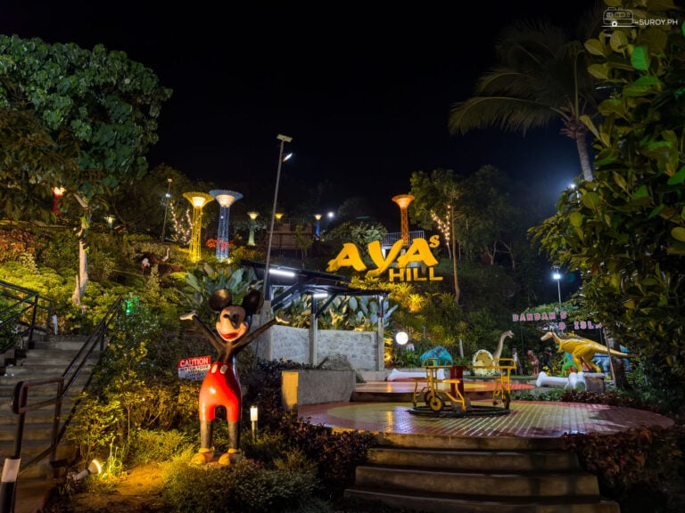
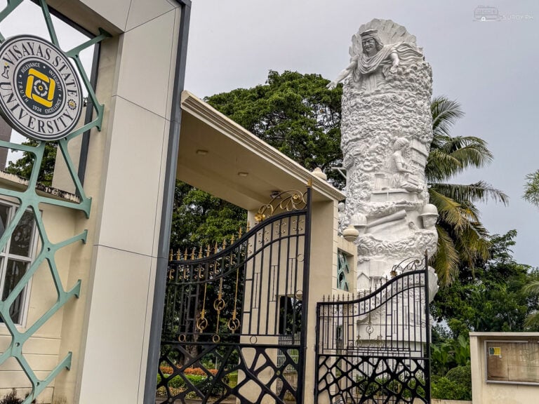
Limasawa sits offshore from Padre Burgos, reached by public boat, and is where the first Mass in the Philippines is marked. North of the bridge the road runs up to Baybay, where there is a cluster worth a day: Lintaon Peak and its blossoms, the sea of clouds cafe up in the hills, Aya’s Hill, the VSU campus and its beach, and the city plaza on the water. Keep going north and you reach San Juanico and Kalanggaman Island.
Watch · The longest and the tallest
Two bridges in one clip: CCLEX in Cebu, the longest in the country, and Agas-Agas in Sogod, the tallest. Both flown by Suroy.ph.
Questions people actually ask
How tall is the Agas-Agas Bridge?
The deck sits 89 meters, or 292 feet, above the ravine floor. That is the tallest of any bridge in the Philippines. The two piers holding it up measure 73 meters and 75 meters from the ground.
How long is the Agas-Agas Bridge?
350 meters, or 1,150 feet, with a center span of 177 meters. The figure of 400 meters that appears on many pages is wrong.
Is the Agas-Agas Bridge zipline still open?
No. Zipline Leyte ran an 880 meter twin cable over the ravine from April 2011, lost its license to operate in October 2014, and has not carried passengers since. Nothing has replaced it. Checked 25 August 2026.
Is there an entrance fee?
None. The viewing decks and the parking are free and the bridge carries no toll, because it is an ordinary section of national highway.
Can you walk across it?
Yes. The bridge is signed as carrying pedestrians as well as vehicles. It is still a live two lane national highway with buses and cargo trucks on it, so stay hard against the rail and do not stop in the carriageway to take a photograph.
Can you fly a drone at Agas-Agas Bridge?
There is no posted restriction at the bridge and no ordinance that could be found. National rules apply as normal, and there is one thing here that catches people out: the ground falls away 89 meters under the deck, so your altitude above the launch point and your altitude above the valley floor are two very different numbers. Fly to the lower of them. The full rules are in our guide to drone regulations in the Philippines.
Where exactly is the Agas-Agas Bridge?
Barangay Kahupian, Sogod, Southern Leyte, on the Pan-Philippine Highway between Mahaplag and Sogod town. The nameplate on the parapet reads KM 1006 + 972.6.
Suroy Wear · Statement Series
One word for a road that kept sliding away.
Padayon. Keep going. It is what people say here when stopping was never really an option, and it is what an engineer says when the hillside wins twice and you build over the top of it anyway.
Wear the story
Padayon Tee · ₱999