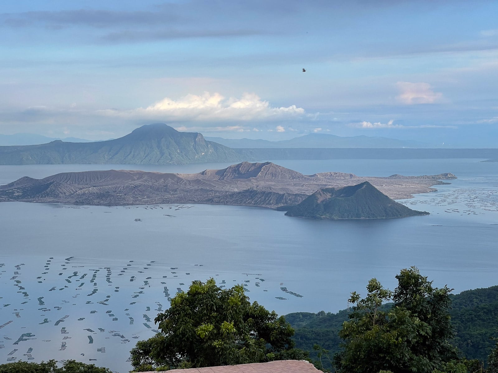

Taal Volcano in 2026: The Island Is Closed, the View Is Not
Taal Volcano in 2026: current alert level, why Volcano Island is still closed, what the lake boats really do, Tagaytay viewpoint fees and how to get there.
Alert Level 1 since July 2022, four minor eruptions in July 2026 alone, and no legal way onto Volcano Island since January 2020. Photographed from the Tagaytay ridge in 2018 and 2021, and from the far shore at San Nicolas in 2022, which is the whole point. Fees and logistics checked August 2026.
The best view of Taal is free, and it is from a road.
The Tagaytay ridge runs above the northern rim of the caldera at about six hundred meters, and from almost any point along the Aguinaldo and Nasugbu highways the whole thing opens up at once: the lake, the island in the lake, the crater on the island. There are paid viewpoints along that ridge and they are worth the small fee for the parking and the railing. None of them shows you anything the roadside does not.
That matters more than it used to, because the ridge is now the main event rather than the warm up. The boat ride to Volcano Island, the walk to the crater rim, the horse at the bottom of the trail: all of that ended in January 2020 and none of it has come back.
What follows is what Taal is, what it is doing right now, where to stand, and what it costs.
What Taal actually is, named correctly
The nesting is the famous part and it is described wrongly more often than not. Working outward: Vulcan Point is a rocky islet about forty meters long. It sits in the Main Crater Lake, the lake filling the crater at the center of the island. That crater sits on Taal Volcano Island, which PHIVOLCS abbreviates TVI, roughly five kilometers across and about 23 square kilometers. The island sits in Taal Lake. Taal Lake fills a caldera 25 to 30 kilometers across, and that caldera is the actual volcano in geological terms. All of it sits on Luzon.
An island, in a lake, on an island, in a lake, on an island. Read outward from Vulcan Point and the sentence is true. Read it with the wrong number of levels, which is common, and it is not. The summit stands at 311 meters, at 14.0100° N, 120.9975° E.
Vulcan Point is not the largest of its kind. It held that title until 2012, when satellite imagery identified a larger third-order island on Victoria Island in Nunavut, Canada. It is still remarkable. It is not unique and it is not the biggest.
Vulcan Point was not destroyed in 2020. The January 2020 eruption drained the Main Crater Lake and broke the nesting for a while, and the rains refilled it. What Vulcan Point lost was its vegetation.
And a geographic correction that shapes every set of directions. Tagaytay is in Cavite, not Batangas, and it is a viewing ridge rather than the volcano location. The volcano is in Taal Lake, in Batangas, and the lakeshore town is Talisay.
What the eruption did to the island
Two photographs in this guide were taken four years apart and they are the clearest way to understand what happened here.
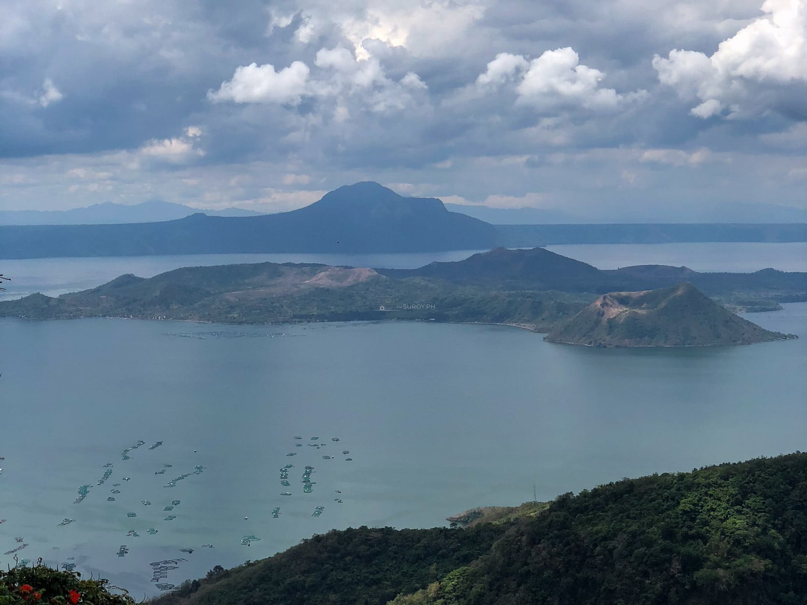
The first is from the Tagaytay ridge on 20 May 2018, at 14.1016° N, 120.9495° E, 658 meters up. Volcano Island is green. Vegetation runs across the whole of it and the crater reads as a soft rim in the middle of a wooded island.
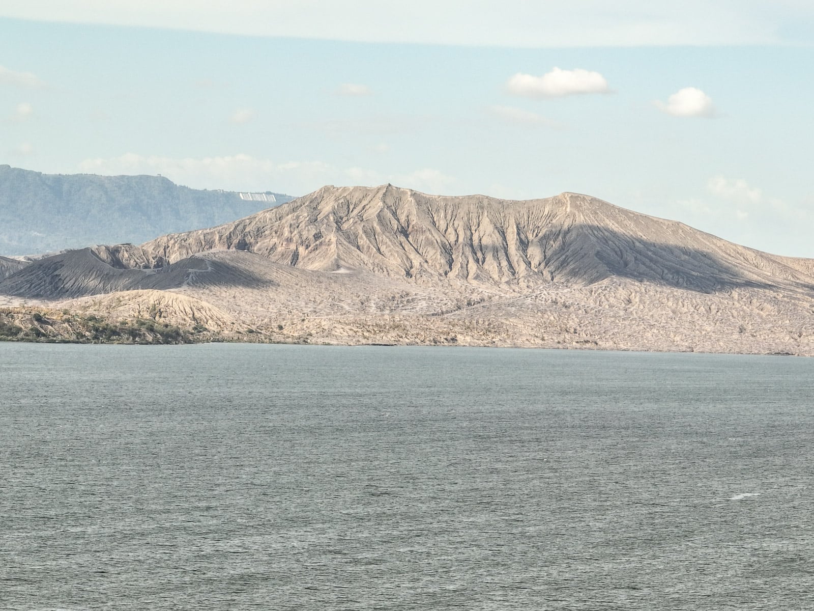
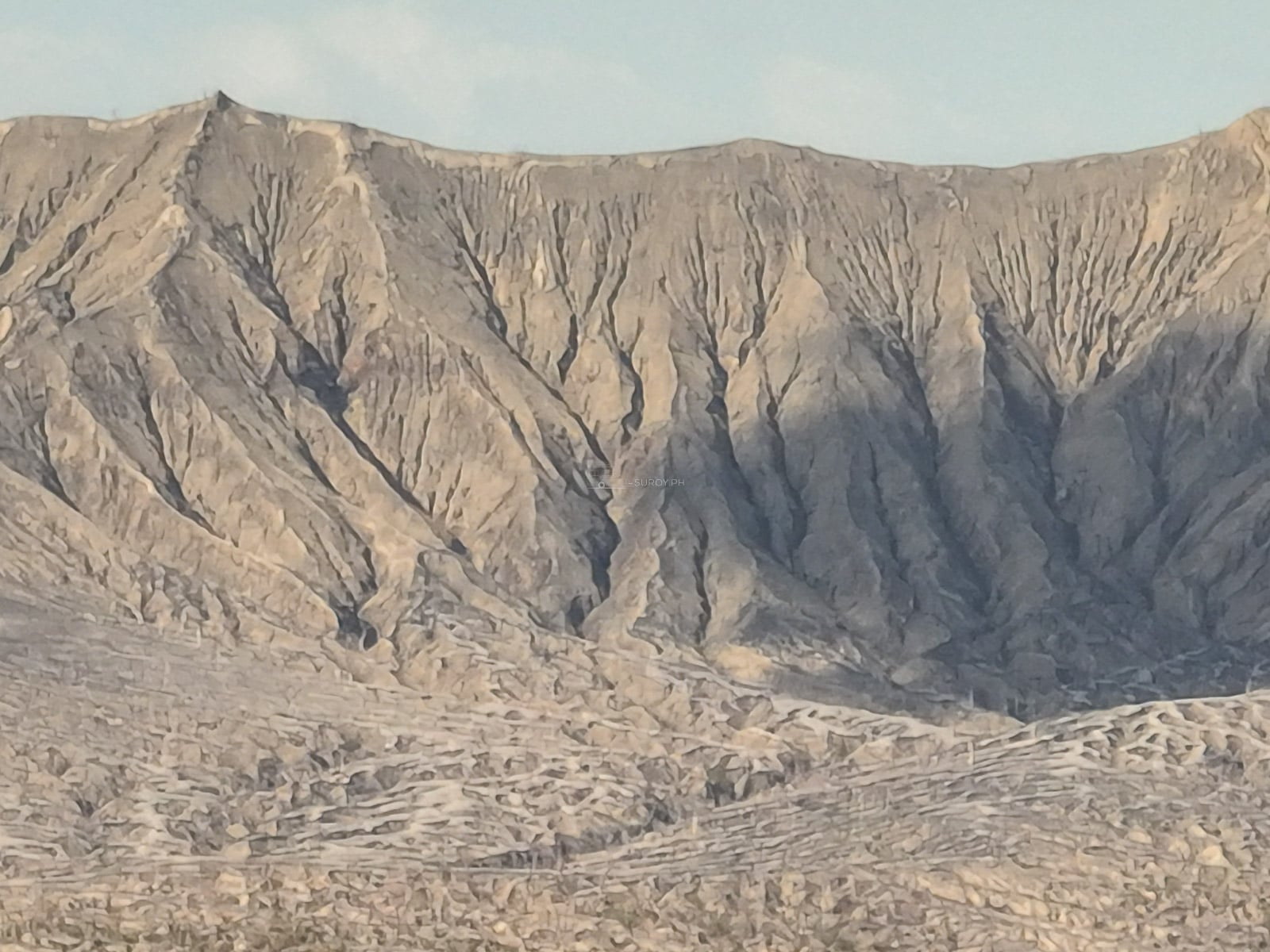
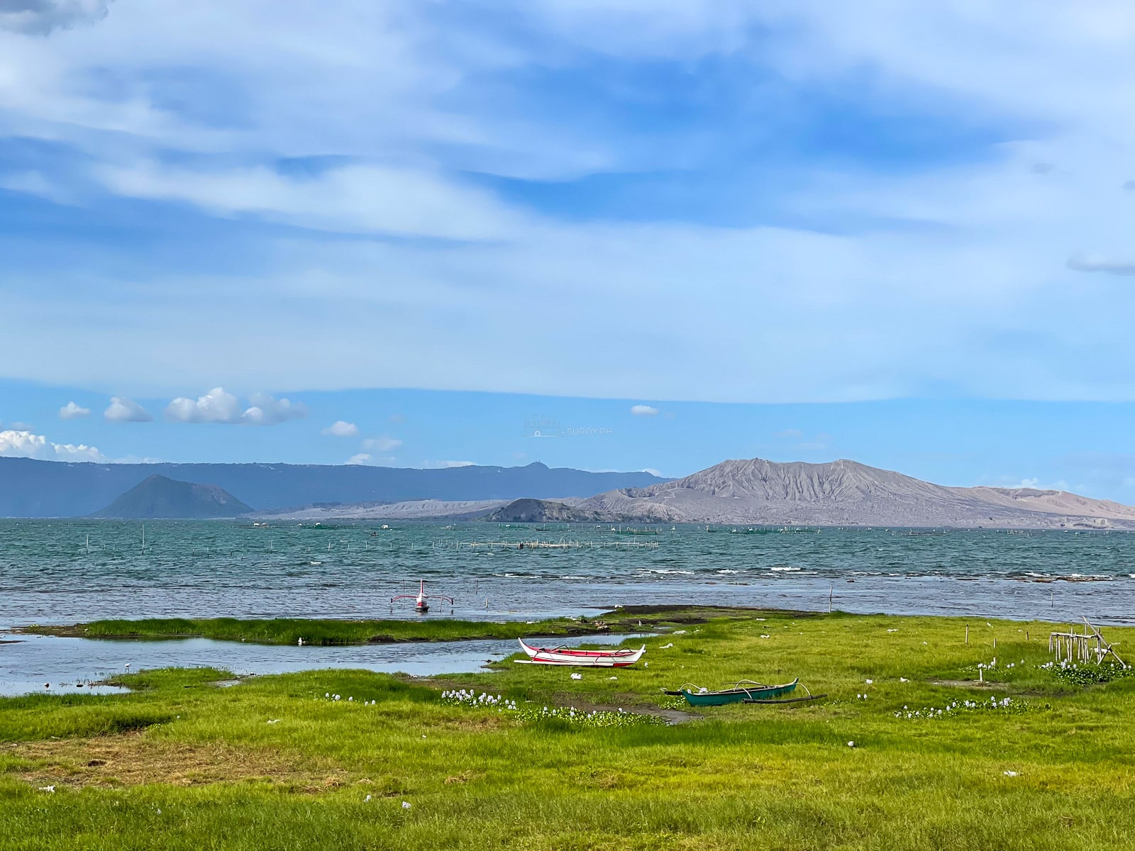
The second is from the southern shore of the lake at San Nicolas on 27 March 2022, looking north across about ten kilometers of water. The same island is gray. The cone is bare ash, cut top to bottom with erosion gullies, and the green stops at the waterline.
Between those two frames sits the January 2020 eruption, which drove a column into the stratosphere, buried the island, drained the crater lake and displaced about 8,000 residents. Nothing about the shape of the place is the same. That is why every price, boat route and trail description written before 2020 is worthless now, and why so much of what is still online is exactly that.
Status, checked August 2026
Alert Level 1, Low Level Unrest, on the 0 to 5 PHIVOLCS scale. In force since 10 July 2022.
That figure is stable and it is widely misread. PHIVOLCS attaches the same sentence to it every time: Alert Level 1 should not be taken to mean unrest has ceased or that the threat of eruption has gone, and the volcano remains in an abnormal condition.
Here is what Alert Level 1 has actually looked like.
| Date | Event |
|---|---|
| 12, 15, 16 Feb 2025 | Three minor phreatic eruptions, three to four minutes each |
| 25 to 26 Oct 2025 | Four eruptions, plumes 1,200 to 2,100 m, localised pyroclastic density currents, ashfall in Laurel and Agoncillo |
| 23 Nov 2025 | One phreatomagmatic event, gray plume to 750 m |
| 9 Jan 2026 | Minor phreatomagmatic event, four minutes, plume 900 m |
| 30 Jun 2026 | Phreatomagmatic eruption, about four and a half minutes, plume 1,200 m |
| 12, 16, 17, 21 Jul 2026 | Four minor phreatomagmatic eruptions. The 21 July plume reached about 2,000 m and drew an ash advisory |
Not one of those moved the alert level. Anyone writing that Taal has been quiet since 2020 has not looked at a bulletin.
The most recent readings. On 21 August 2026 the network logged 46 volcanic earthquakes, up from 14 the day before, with two tremor episodes running between two and 245 minutes. Sulphur dioxide was 271 tonnes on 20 August against an average of 107 tonnes a day over 16 to 19 August. On 16 August the flux was 107 tonnes with no upwelling in the Main Crater Lake and no vog detected. For scale, the long term mean since 2021 is around 4,847 tonnes a day, so current output is two orders of magnitude below the level that produced the vog episodes of 2023 and August 2024.
One thing worth knowing before anyone drives down to watch an eruption. We did exactly that on 27 March 2022, the day after the alert level went to 3, because the news said Taal had erupted. There was no explosion to see that afternoon. That is the ordinary outcome, and it is worth saying plainly, because most of what comes back from a volcano in the news is a photograph of a mountain doing nothing.
Why you cannot go to the island
Four separate prohibitions sit on Taal Volcano Island, built by four different authorities for different reasons. Any one of them would be enough.
- PHIVOLCS. The entire island is a Permanent Danger Zone. Entry into TVI, and specifically the Main Crater and the areas along the Daang Kastila fissure, must remain strictly prohibited. That wording is carried in bulletin after bulletin.
- Batangas province. The governor declared the island a no man land, closed to residents and visitors alike.
- DENR, through the protected area management board. PAMB Resolution No. 65 declares Taal Volcano Island a No Human Settlements Zone, implemented by the protected area office for the Taal Volcano Protected Landscape.
- Talisay. A registration system at the lakeshore. Nobody sails without logging in and out.
It is enforced. Between 8 and 10 February 2026 four foreign tourists hired a motorbanca and landed at Barangay Alas-as in San Nicolas to photograph the crater. The Philippine Coast Guard, PHIVOLCS and the protected landscape board opened a joint investigation into the violations and the legal liabilities. The boat operator said he did not know about the restriction. That was not treated as a defense, and it should not be treated as one by anybody hiring a boat now.
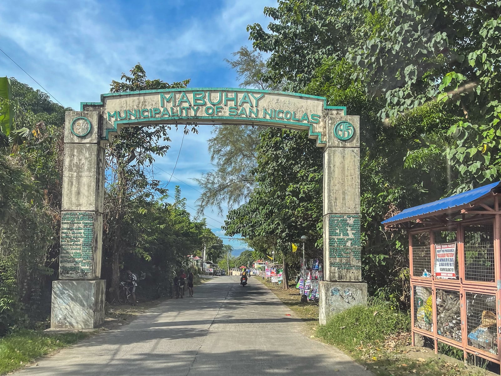
San Nicolas is worth naming twice, because it is also where the 2022 photographs on this page were taken from. The difference between those two trips is not the town. It is that one of them stayed on the shore.
About 8,000 people lived on that island before January 2020. They have not been allowed back either. Talisay officials made a public appeal in July 2025 for a limited return of visitors to areas near the tourism center, describing what six years of closure has done to boat operators, guides, restaurants and vendors. The decision sits with national government and nothing shows the appeal has been granted.
The volcano is not being unreasonable about this. The February 2026 statement from PHIVOLCS put it plainly: Taal can produce sudden phreatic or phreatomagmatic eruptions with little or no warning, and its gases can suffocate. The October 2025 events lasted between one and four minutes and included pyroclastic density currents. There is no reliable visual cue that gives a person on the island time to leave. That absence of warning is the entire reason for the prohibition.

What is still being sold, and what it is worth
This part is uncomfortable and it is the most useful paragraph on the page.
Major booking platforms still list a Taal Volcano crater trek with horse riding. One dedicated site advertises a 30 to 45 minute hike to the crater rim, quotes ₱1,500 to ₱2,500 per person and itemises a ₱30 registration and a ₱150 environmental fee, all of which sounds exactly like the product that existed in 2019. Yacht club listings still carry the words volcano tour.
A booking confirmation is not a permit. Those listings are stale inventory. Some of them resolve into a lake circuit that never lands, which is a fine day out sold under the wrong name. Some of them resolve into an argument on a beach. And the ones that do land are asking a paying customer to commit the violation that four people are currently under investigation for.
Anyone who has already booked one should ask a single question before paying a balance: does this boat land on Volcano Island. If the answer is yes, that is the whole answer.
Boat tours on Taal Lake
They run, from Talisay, and they do not land. What you get is a bangka circuit of 45 minutes to an hour and a half, out toward the island and around it, viewing the volcano from the water. Some crews offer a half circuit or a full one.
What it costs: ₱1,500 to ₱2,000 for the boat, up to about six passengers, plus a ₱100 per person lake and environmental fee, ₱50 to ₱100 parking, and ₱300 to ₱500 for the guide. Recent visitors report being quoted ₱3,000 to ₱5,000 for a longer circuit of around two hours. Prices are negotiated at the shore rather than posted, so the spread is real and the number depends on the day, the group and the boatman.
The Taal Lake Yacht Club on the Talisay to Laurel road is the organized alternative. Day entry for non members is ₱100 per person per hour, or ₱400 per person per day credited against a rental. The Taal Explorer sailboat is ₱1,000 per person for the first hour and ₱700 for each hour after, minimum seven passengers. A Hobie Getaway is ₱2,100 an hour. Cabanas run ₱300 to ₱800 a day depending on size, and camping is available.
One thing is genuinely unresolved and it matters. Two PHIVOLCS advisories issued in July 2026 carry a line stating that entry to the island, boating on Taal Lake, and flying aircraft near the volcano all remain prohibited. The bulletin text published in the same period names only the island, the Permanent Danger Zone, the Main Crater, the Daang Kastila fissure and aircraft, with no boating clause at all. Meanwhile boat tours operate openly from Talisay every day.
Those positions do not agree. The most likely reading is that the boating line is carried over from bulletins written at a higher alert level, but that is a reading and not a fact, and this page is not going to turn it into one. What is certain is that the island itself is off limits, and that a boat which stays on the water and outside the danger zone is a different proposition from a boat that lands.
Where to stand: the Tagaytay ridge
Tagaytay City sits on the caldera rim in Cavite and its main road is a continuous viewing gallery. The paid viewpoints add parking, a railing, a toilet and a place to eat.
| Viewpoint | Entrance | Hours | Notes |
|---|---|---|---|
| People’s Park in the Sky | ₱50 adult, ₱40 senior, under 7 free | 6:00 AM to 7:00 PM | Highest point in Tagaytay. Parking ₱20 to ₱50. Binocular and shuttle rentals on site |
| Picnic Grove | ₱75 | 6:00 AM to 10:00 PM | Parking ₱50 car, ₱75 van, ₱150 bus. Zipline ₱200 to ₱400 depending on day and direction. Horseback ₱350 for 30 minutes |
| Sky Ranch | ₱120, senior ₱96 | Mon to Fri 10:00 AM to 8:00 PM, weekends 8:00 AM to 9:00 PM | Sky Eye ferris wheel ₱200 per ride. Ride passes sold online only, admission bought separately |
| The roadside | Free | Always | The ring road gives the same view. Pull over safely and stay out of the traffic lane |

People’s Park in the Sky is the one to pick if you are choosing one. It is the highest of the three, the entrance is the cheapest, and the walk up to the old presidential rest house shell is part of the appeal. The site sits in the same family as the summit structures in our Sacred Heights piece.
The other place to stand is the southern shore. From the lakeshore around San Nicolas the volcano sits about ten kilometers north across open water, at roughly 13.9248° N, 120.9600° E, and the view is completely different from the ridge: lower, flatter, with fish pens in the foreground and the cone filling the horizon rather than sitting in a bowl below you. It is the angle that shows you how big the thing is, and almost no visitor sees it.

Mahogany Market on Mahogany Avenue is free, has no gate, and is where the bulalo actually is. Stalls set up around dawn and wind down between 6:00 and 7:00 PM. There is no posted signage for the hours, which is worth knowing before anyone drives up for a late one.
Go in the morning. The ridge fogs in through the afternoon in the wet season and the clearest air is before noon in any month.
A volcano on an island in a lake, with its own crater lake on top, is a sentence that only works in one province. That is the Batangas Tee, from the Island Series.
Hikes near Taal, and the one everybody still recommends
Mount Maculot is closed. All trails, all sections, every purpose, under Cuenca Executive Order No. 1, Series of 2020. The Cuenca tourism office confirmed on 25 July 2026 that the suspension holds for the foreseeable future, tied to rehabilitation, a carrying capacity assessment and a tourism master plan. There is no reopening date. The Rockies is still the default alternative viewpoint recommendation across most Taal coverage, six years after it stopped being possible.
Mount Batulao in Nasugbu is the working substitute. 811 meters, four to six hours round trip, two routes: the Old Trail is shorter and steeper with rope sections, the New Trail is longer and rolls. A guide is mandatory as of 2026 at around ₱800 for a group of up to five. Trail checkpoint fees run ₱60 to ₱100 and there are several. Parking is ₱100 for a car. Getting there: bus from DLTB Buendia or PITX toward Nasugbu, ₱250 to ₱350 one way, two and a half to three hours. Get off at KC Hillcrest, not in Nasugbu town, then a tricycle to the jump off for about ₱150.
Getting there from Manila
By bus
DLTB runs the route from LRT Buendia in Pasay and from PITX in Paranaque. Board anything signed Nasugbu via Aguinaldo Highway or Nasugbu via Tagaytay, because Tagaytay is on the way rather than the terminus. Buendia departures run roughly 3:00 AM to 10:00 PM. Fare is ₱90 to ₱200 depending on terminal and class, and it takes about two hours in decent traffic, three when the ridge is busy.
Tagaytay down to Talisay: charter a tricycle, ₱150 to ₱200 for the vehicle. It is a steep descent off the ridge and there is no comfortable public alternative. There is no documented direct bus or van from Manila to Talisay, so the practical routings are through Tagaytay or through Lipa City, which sits 25 to 35 minutes from Talisay.
By car
SLEX from Magallanes or Alabang, exit at Santa Rosa, then the Santa Rosa to Tagaytay road, about 25 kilometers uphill. Roughly 60 kilometers from Metro Manila, an hour and a half to two and a half hours, with another half hour to an hour on a weekend morning. Tolls, Class 1: Magallanes to Santa Rosa ₱111 one way, Alabang to Santa Rosa ₱84 one way. RFID is effectively mandatory now, with cash lanes limited and slow at peak.
CALAX is the newer option. The Cavite to Laguna Expressway is fully operational, about 44.6 kilometers carrying around 45,000 vehicles a day, with the Santa Rosa and Tagaytay exit serving the main commercial strip and the Silang Interchange serving the southern side of the city. A 7.8 kilometer section linking Aguinaldo Highway in Silang to Governor Drive in General Trias opened in 2026. Aguinaldo Highway through Cavite remains the toll free route and remains the slow one.
Flying a drone over Taal
The airspace over Taal is not ordinary airspace, and this is the part almost no drone content covers.
CAAP issues rolling NOTAMs over the volcano restricting flight from the surface up to 11,000 feet. Two documented instances: one effective 3 October 2025 running to the following morning, and one effective 6 January 2026 issued alongside notices for Kanlaon, Bulusan and Mayon. These are short validity notices that get re-issued and extended, which means the airspace has to be checked on the day of the flight rather than once before the trip.
Neither of those notices names drones specifically, and whether a surface to 11,000 feet restriction binds a recreational aircraft flying below 120 meters is not something any published source resolves. It is stated here as an open question because that is what it is.
PHIVOLCS separately and consistently advises pilots to avoid flying over the island, on the basis that ash and ballistic fragments from a sudden eruption are a hazard to aircraft.
The protected landscape adds a layer that could not be pinned down. No drone permit requirement, process or fee for the Taal Volcano Protected Landscape exists in public. The DENR precedent elsewhere is real: Mount Pulag carries a total drone ban under a protected area advisory. The right move is a call to the protected area office before flying, and the understanding that the island itself is closed regardless, so there is no lawful launch point on it. Everything national, including the 120 meter ceiling, the 10 kilometer airport buffer and the registration threshold, is in our drone rules in the Philippines guide.
When to go, and the vog question
Best months: December to February. Dry air, the clearest visibility of the year. Early morning is clearest in any month. Dry season runs November to May, rainy season June to October, southwest monsoon and then typhoons.
August is rainy season, but the mornings are frequently clear and the afternoons are not. Cloud and moisture keep the ridge cool and fog it in. Shoot before noon and treat the afternoon as a bulalo problem rather than a view problem.
Vog is volcanic smog, formed when sulphur dioxide output is high and the wind is light. It drifts across the Batangas lakeshore towns and has previously reached the wider Calabarzon region and Metro Manila. The serious episodes were September 2023 and August 2024, both severe enough to suspend classes across affected areas, and both driven by output far above what the volcano is producing now. No vog episode has been reported in 2025 or 2026, and the bulletin of 16 August 2026 recorded none.
If it does return, the health advice is straightforward: volcanic gas irritates the eyes, throat and respiratory tract, and how badly depends on concentration and how long you breathe it. Anyone with asthma or a heart condition, and anyone traveling with small children or older relatives, should watch the bulletins rather than the sky. What ashfall does and how to handle it is covered in our volcanic ashfall survival guide.
The other Taal, and the church claim
There are two Taals and search engines confuse them as often as travelers do. Taal Volcano is in the lake, viewed from Talisay and Tagaytay. Taal Heritage Town is the municipality of Taal, Batangas, 40 to 50 minutes by road from the lakeshore and not on the water at all.
It is a Spanish era town of ancestral houses: Casa V, Villa Tortuga, the Villavicencio houses, the Apacible Museum, the Agoncillo mansion known as the White House. Entry to an ancestral house runs about ₱80. Caysasay Church and the Sta. Lucia well are free.
Its centrepiece is the Basilica of Saint Martin of Tours, and here is the correction. It is not the largest Catholic church in Asia. That claim is repeated on page after page and no authoritative source supports it. The defensible version is that it is the largest church building in the Philippines and the largest Augustinian church, which is a strong enough claim on its own. It measures 88.6 meters long and 48 meters wide, with a nave 15.5 meters across, a facade 28 meters high and a cupola reaching 44.5 meters.
The history is documented: groundbreaking in 1856, inaugurated incomplete in 1865, finished in 1878, damaged in the Luzon earthquakes of the 1880s, declared a Minor Basilica by Pope Pius XII on 8 December 1954, and declared a National Historical Landmark on 14 January 1974 under Presidential Decree No. 375.
While you are on that side of the lake, Fantasy World in Lemery is twenty minutes away, and Montemaria in Batangas City is the other landmark worth the detour.
What a Taal day trip costs
Two people from Manila, own car, one day.
| Item | Cost |
|---|---|
| Tolls, Magallanes to Santa Rosa, return | ₱222 |
| Fuel, roughly 130 km round trip | ₱900 to ₱1,200 |
| People’s Park in the Sky, two entries | ₱100 |
| Parking | ₱50 |
| Lunch, bulalo for two at Mahogany Market | ₱600 to ₱900 |
| Ridge day total | ₱1,872 to ₱2,472 |
| Add: boat circuit from Talisay, per boat | ₱1,500 to ₱2,000 |
| Add: lake fee, two people | ₱200 |
| Add: guide | ₱300 to ₱500 |
| With the lake | ₱3,872 to ₱5,172 |
By bus for two people the ridge day comes in around ₱1,200 to ₱1,700 all in, which is the cheapest good view in Luzon.
Practical notes
- Mornings. Clear air, empty viewpoints, no coach parties. The ridge is a different place at 7:00 AM.
- Bring layers. Six hundred meters of elevation and a lake breeze. Tagaytay runs several degrees cooler than Manila and it surprises people every time.
- Cash. The viewpoints, the parking attendants, the tricycles and the market all want it.
- Weekends are the whole problem. Metro Manila drives to Tagaytay on Saturday and Sunday. A weekday trip is a different city.
- Check the bulletin before you drive, not because a day trip is dangerous at Alert Level 1, but because a raised alert level closes roads and changes what the day looks like.
- Do not hire a boat that offers to land you on the island. It is prohibited, it is enforced, and the operator not knowing is not a defense for the passenger.
Alert level, fees, fares and opening hours in this guide were checked on 22 August 2026. The photographs are our own, taken from the Tagaytay ridge in May 2018 and June 2021, and from the southern lakeshore at San Nicolas in March 2022.
Suroy Wear · Island Series
Wear the province.
A volcano on an island in a lake, with its own crater lake on top. Anilao reefs an hour down the coast. Batangas never had to choose.
Shop the Island SeriesTaal Volcano FAQ
Can you climb Taal Volcano in 2026?
No. Taal Volcano Island has been closed since the January 2020 eruption. It is a Permanent Danger Zone under PHIVOLCS, a no man land under a Batangas provincial declaration, and a No Human Settlements Zone under PAMB Resolution No. 65. Entry is prohibited and it is enforced.
What is the current Taal Volcano alert level?
Alert Level 1, Low Level Unrest, on the 0 to 5 scale. It has been at Level 1 since 10 July 2022. Alert Level 1 does not mean quiet. Taal produced four minor phreatomagmatic eruptions in July 2026 alone without the level moving.
Are the Taal Volcano tours on booking sites legitimate?
Lake circuits are. Anything advertising a landing on Volcano Island or a hike to the crater rim is selling a product that ended in January 2020. Ask one question before paying: does this boat land on the island.
Can you take a boat on Taal Lake?
Boat tours run daily from Talisay and circle the island without landing, at ₱1,500 to ₱2,000 for the boat plus a ₱100 per person lake fee. Two PHIVOLCS advisories in July 2026 carried a line prohibiting boating on the lake, while the bulletin text from the same period named only the island, the crater and the Daang Kastila fissure. Those positions do not agree and the tours operate.
Where is the best view of Taal Volcano?
The Tagaytay ridge. People’s Park in the Sky at ₱50 is the highest and cheapest of the paid viewpoints, and the roadside along the ring road is free and shows you the same thing. The southern lakeshore around San Nicolas gives a lower, closer angle across the water that most visitors never see.
Is Mount Maculot open?
No. All trails and all sections are closed under Cuenca Executive Order No. 1, Series of 2020, confirmed still in force on 25 July 2026 with no reopening date. Mount Batulao in Nasugbu is the working alternative.
How do you get to Taal Volcano from Manila?
Bus from LRT Buendia or PITX toward Nasugbu via Tagaytay, ₱90 to ₱200, about two hours. By car, SLEX to the Santa Rosa exit then up, with ₱111 in tolls each way from Magallanes. For the lakeshore, charter a tricycle down from Tagaytay to Talisay for ₱150 to ₱200.
Is Taal Volcano safe to visit?
The ridge and the lakeshore are ordinary places to spend a day at Alert Level 1. The island is not, and that is why it is closed. Taal can erupt with little or no warning, its gases can suffocate, and the events of October 2025 lasted between one and four minutes each.
Is Taal Volcano the same as Taal Heritage Town?
No. The heritage town is the municipality of Taal, Batangas, 40 to 50 minutes from the lakeshore, known for its ancestral houses and the Basilica of Saint Martin of Tours.
Can you fly a drone over Taal Volcano?
Not without checking the airspace on the day. CAAP issues rolling NOTAMs over Taal restricting flight from the surface to 11,000 feet, re-issued and extended repeatedly. PHIVOLCS advises pilots to avoid the island. No protected area drone permit for the Taal Volcano Protected Landscape is published anywhere, so call the protected area office first.