
Barangay Hipodromo: The Cebu Racetrack You Can Still See from the Air
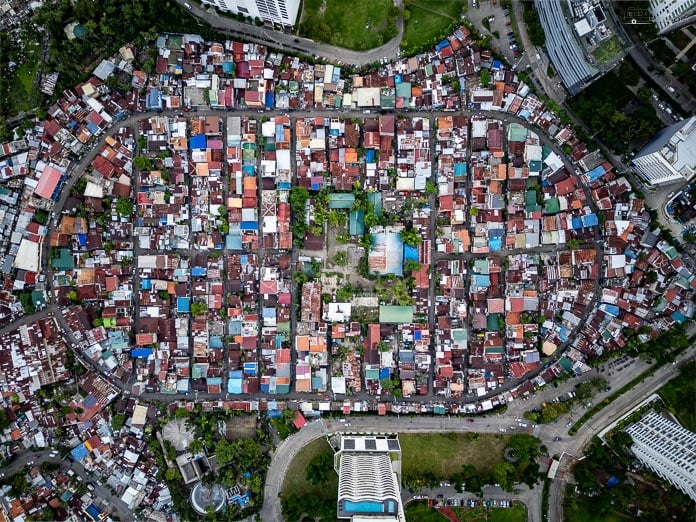
From the air, Barangay Hipodromo is an oval, and that is the whole story. The houses sit inside the line of a Spanish-era horse racing track that was running by 1895, closed for good after the war, and became a relocation site after a fire in the late 1950s. Today 11,291 people live inside the oval, beside the walls of Cebu Business Park. The old track survives as a 915 m road with one way in and one way out.
Barangay Hipodromo (PSA: Hippodromo) · Cebu City · 10.3141° N, 123.9070° E · Checked 29 October 2026
Hipodromo · Cebu City
A racetrack you can still see
Tap a stage.
By 1895
The track
A Spanish-era horse track was running here by 1895, after Manila’s Hipódromo de Santa Mesa made oval racing fashionable. Betting came in 1903. The Japanese occupation shut it, and post-war racing never paid.
Late 1950s
Relocation
After a fire in the Carreta and T. Padilla area, Mayor Sergio Osmeña Jr. opened the empty oval to the families who lost their homes. The barangay split from Mabolo in the early 1960s.
A rosary-shaped plan
The village
The housing authority later laid it out as Mary Immaculate Conception Village, named for an oval plan that reads like a rosary. 11,291 people lived here in the 2024 census.
915 m, one way in
The oval road
The old track survives as a 915 m oval road with one entrance and one exit. Concreting worth ₱10 million started in April 2025.
Cebu Business Park
The neighbor
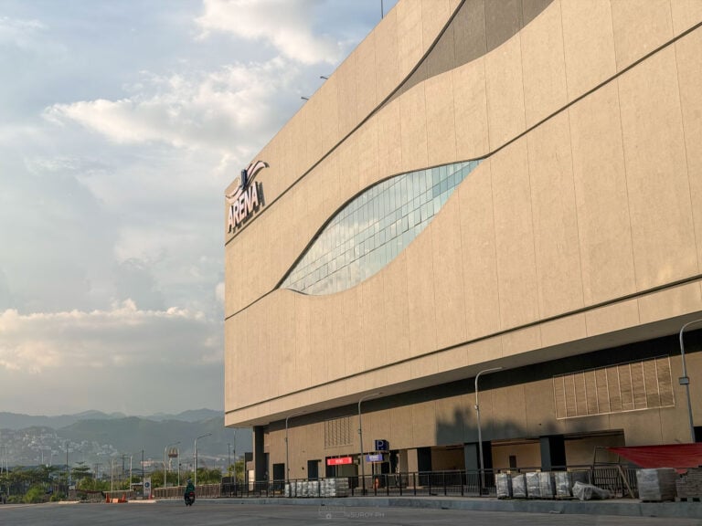
High walls separate the oval from Cebu Business Park and Ayala Center next door. A 3 m access road now links the two after fires in 2018 and 2019.
Checked October 29, 2026.
The racetrack, 1895 to the war
The name is Spanish, from hipódromo, a horse racing track. Cebu’s was established in Mabolo by 1895, after Manila’s Hipódromo de Santa Mesa made oval racing popular in the 1880s. Betting arrived in 1903, and a 1909 postcard shows the British consul serving as president and sole judge. The clubhouse stood at the track entrance on what is now M. J. Cuenco Avenue, opposite the Chinese cemetery. The Japanese occupation stopped the racing, and after the war it never paid again.
From racetrack to barangay
In the late 1950s a fire in the Carreta and T. Padilla area left families homeless, and Mayor Sergio Osmeña Jr. opened the empty oval to them. The settlement split from Mabolo as its own barangay in the early 1960s. The housing authority later laid it out as Mary Immaculate Conception Village, a name tied to its rosary-shaped oval plan.

Hipodromo today
| Population | 11,291 (2024 census); 9,574 in 2020 |
| Neighbors | Zapatera, Lorega San Miguel, Luz, Carreta, Mabolo, Camputhaw, Lahug |
| The oval road | About 915 m, one entrance and one exit; ₱10 million concreting began April 2025 |
| Next door | Cebu Business Park and Ayala Center Cebu, behind high walls |
| Access link | A 3 m road to the Ayala access road, widened after fires in 2018 and 2019 |
It is a residential barangay, not an attraction: narrow lanes, small lots and a one-way loop. Walk it with respect, or see it the way it reads best, from above. Fires have hit the dense lots several times, which is why the access road matters.
Near Hipodromo
The oval is a short walk from Ayala Center Cebu. Fuente Osmeña and downtown landmarks like Magellan’s Cross and Fort San Pedro are a short drive south.
A track, then a refuge, then a barangay, all on the same oval. The Cebu Coordinates tee is for the places that only make sense once you know where they are.
Suroy Wear · Island Series

Cebu, by the numbers.
Coordinates for the island, worn plainly. Made in the Philippines. ₱999.
Wear the story
Frequently asked questions
Was there a racetrack in Cebu?
Yes. A horse racing track was operating in what is now Barangay Hipodromo by 1895. Racing stopped during the Japanese occupation and never resumed profitably.
Why is Barangay Hipodromo shaped like an oval?
The houses fill the footprint of the old racetrack, and the ring road follows the line of the track.
What is the population of Barangay Hipodromo?
11,291 in the 2024 census.
Where is Barangay Hipodromo?
In Cebu City, beside Cebu Business Park and Ayala Center, between Mabolo, Luz, Carreta and Camputhaw.
How do you spell it?
Local usage and the barangay use Hipodromo. The Philippine Statistics Authority lists it as Hippodromo.
History, census figures and road works checked 29 October 2026.