ByPat
Mt. Pinatubo Travel Guide: The 4×4, the Trek, and the Crater Lake
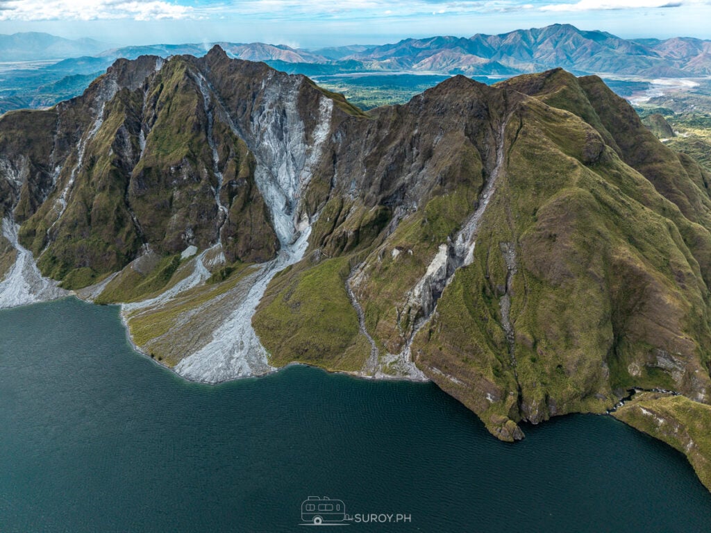
Three hours from Manila, then a 4x4 across the lahar and a walk at the end. The watch read 3.29 kilometers and 256 meters of climb by the time the crater lake came into view.
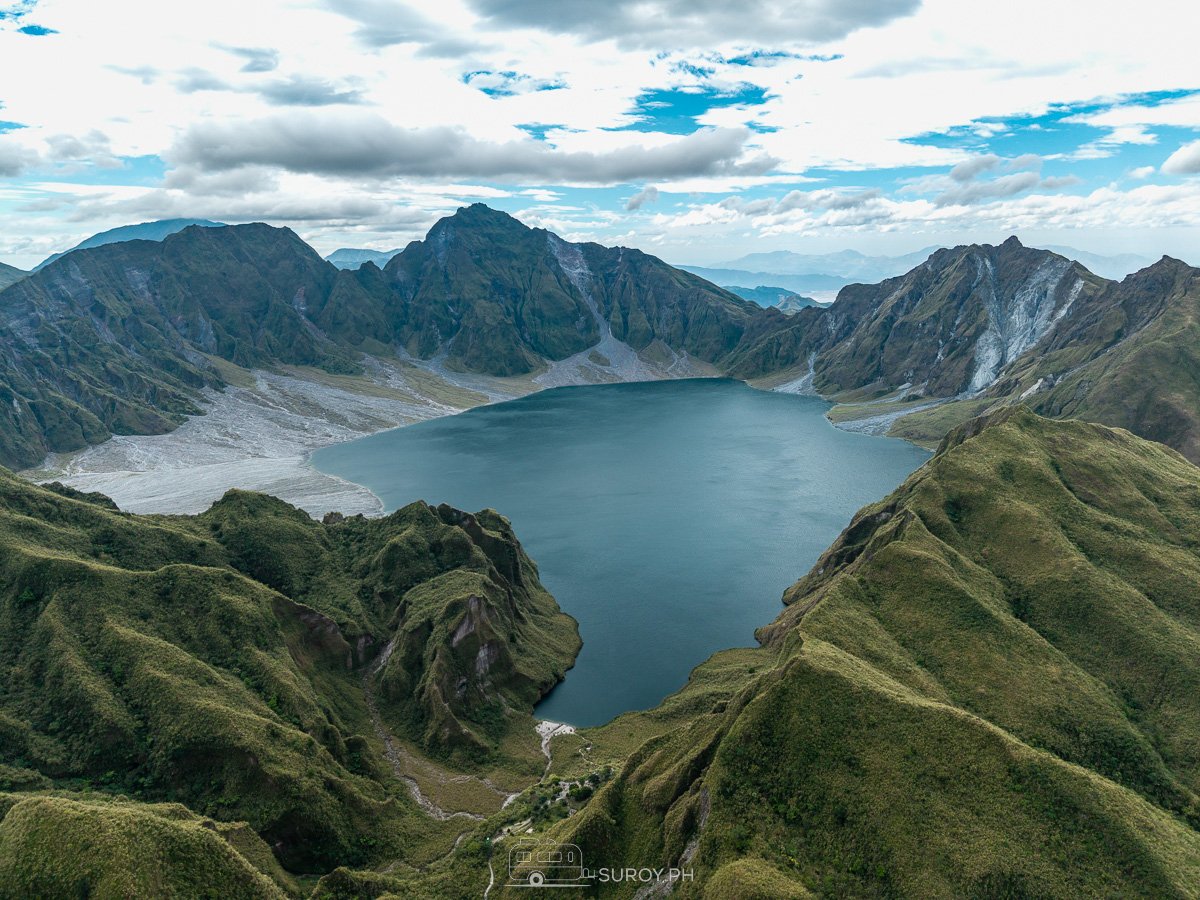
The lake sits in the hole the mountain left. Pinatubo blew in June 1991 in one of the largest eruptions of the last hundred years, and what is left of the summit now holds water the color of bottle glass. Getting to it is a three hour drive from Manila, a 4×4 across the lahar plain, and a walk at the end. Suroy.ph’s watch read 3.29 kilometers and 256 meters of climb by the time the rim came into view.
Why Visit Mt. Pinatubo?
- Iconic Crater Lake. A shimmering blue-green lake formed in the aftermath of the 1991 eruption, offering a surreal landscape unlike any other in the Philippines.
- Thrilling 4×4 Adventure. The journey to the jump-off point takes you through lahar fields and rugged terrains, offering a thrilling off-road experience.
- Scenic Trekking Experience. A moderate hike leading to breathtaking panoramic views of the crater.
- Toblerone Hills. Unique lahar-formed hills resembling the shape of Toblerone chocolate bars, a famous landscape along the trek.
- Rich Historical & Geological Significance. Once considered dormant, Mt. Pinatubo’s eruption was one of the most powerful in modern history, reshaping the entire region.
- A Testament to Nature’s Power – A true beautiful disaster, Mt. Pinatubo showcases the delicate balance between destruction and rebirth, offering visitors a rare glimpse into nature’s ability to create beauty from chaos.


The Indigenous Aeta Community
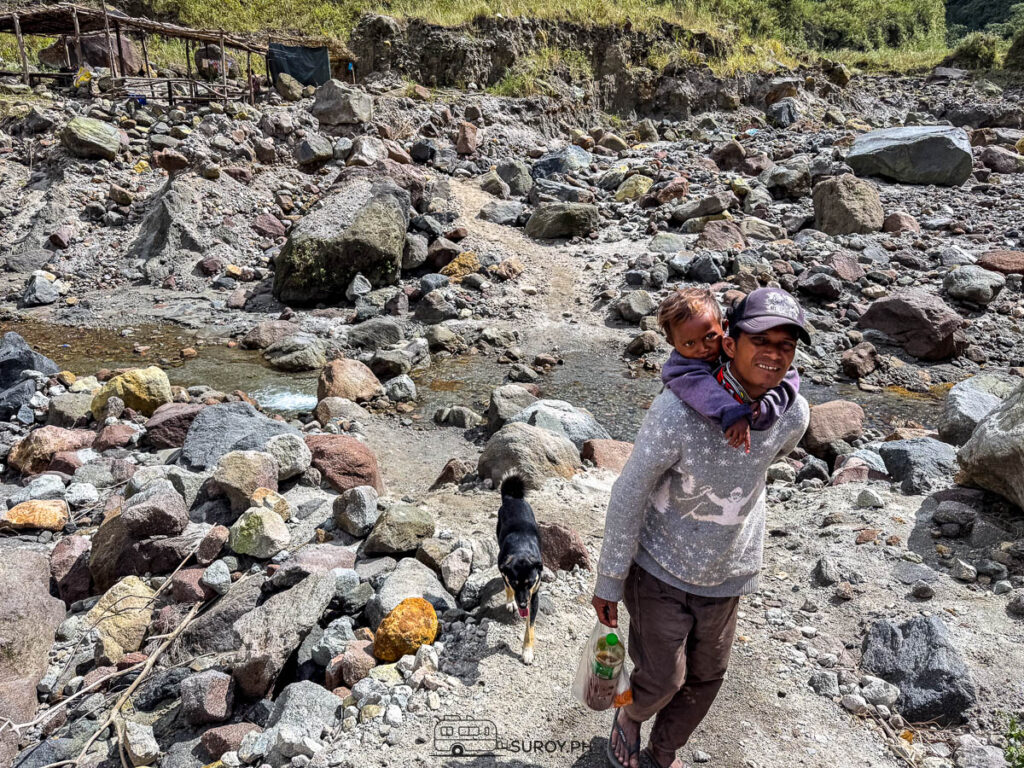
The Aeta people, one of the oldest indigenous groups in the Philippines, have long called the lands surrounding Mt. Pinatubo their home. They lived harmoniously with nature, relying on the forest for food, shelter, and medicine. However, the 1991 eruption devastated their ancestral lands, displacing many and forcing them to rebuild their way of life.
Today, the Aetas continue to thrive and preserve their cultural heritage. Many of them serve as local guides, offering visitors insight into their traditions, survival skills, and deep connection with the land. Interacting with the Aeta community is an enriching experience, providing a deeper understanding of how they have adapted to the changes brought by the eruption.
When visiting Mt. Pinatubo, take the opportunity to support Aeta-led tours, purchase their handmade crafts, and learn about their way of life, a meaningful way to contribute to their sustainable livelihood while appreciating their resilience and culture.

Next on Suroy.ph
How to Get to Mt. Pinatubo
From Manila:
- By Private Vehicle: Drive via NLEX-SCTEX and exit at Capas, Tarlac. Travel time is around 3 hours.
- By Public Transport: Take a bus bound for Tarlac or Capas, then hire a tricycle to the tourism registration area at Sta. Juliana, Capas.
Tour Registration & Fees
- Visitors must register at the Capas Tourism Office in Tarlac. Foreign nationals are required to register one week before the date of the hike.
- Tour packages typically include a 4×4 ride, guide, environmental fees, and permits.
The Mt. Pinatubo Trekking Experience
The 4×4 Ride
Your adventure begins with an exhilarating 4×4 ride across the Crow Valley, an expansive wasteland covered in lahar, remnants of the 1991 eruption. The bumpy ride through rocky streams and moon-like landscapes makes for a unique experience.


Toblerone Hills: A Unique Natural Formation
One of the highlights of the 4×4 trail to Mt. Pinatubo is passing through the Toblerone Hills, a fascinating sight of triangular lahar-formed hills that resemble the famous Toblerone chocolate bars. These hills, shaped by the volcanic ashflows from the eruption, provide an excellent photo opportunity and a chance to witness nature’s resilience and artistry.


The Hike to the Crater
- Trek Duration: ~1.5 to 2 hours (5.5 km)
- Difficulty Level: Moderate, suitable for beginners with basic fitness.
- Trail Highlights: River crossings, scenic canyons, and volcanic ash formations.
- Crater Arrival: Witness the breathtaking turquoise lake, which changes shades depending on the weather and season. The crater, once a scene of destruction, now serves as an oasis of serenity, reflecting the power of rebirth after devastation.


Best Time to Visit Mt. Pinatubo
- Ideal months: November to May (dry season) for the best trekking conditions.
- Avoid the rainy season (June to October) as trails may be hazardous.
What to Bring
- Hiking gear. Comfortable trekking shoes, sun protection (hat, sunscreen, sunglasses).
- Essentials. Water (at least 2L), energy snacks, first aid kit.
- Camera. For capturing the magnificent views.
- Extra Clothes. You will get wet from river crossings.
Nearby Attractions
- Church of San Guillermo – A historic half-buried church in Bacolor, Pampanga, a haunting yet beautiful reminder of Mt. Pinatubo’s immense power and resilience.
- Mt. Samat National Shrine. A memorial honoring Filipino and American soldiers who fought during World War II.
- Padre Pio Mountain of Healing. A revered pilgrimage site known for its spiritual and healing significance.
- Divine Mercy Shrine. A peaceful and sacred destination ideal for reflection and prayer.
Responsible Tourism: Leave No Trace
To preserve Mt. Pinatubo’s beauty, practice responsible tourism by bringing back your trash, respecting local communities, and staying on designated trails.

What to Do in Case of Volcanic Ashfall
While Mt. Pinatubo remains a dormant volcano, it is always best to stay prepared. If you ever find yourself in an ashfall event, knowing how to protect yourself is crucial. Read our comprehensive guide on what to do during a volcanic ashfall to stay informed and ready.
Conclusion
Mt. Pinatubo is more than just a destination, it is a symbol of resilience, transformation, and the awe-inspiring power of nature. From the chaos of one of history’s most explosive eruptions, it has emerged as a breathtaking paradise, captivating all who step foot on its trails. Whether you seek adventure, reflection, or simply a moment to witness something truly extraordinary, Mt. Pinatubo stands as a testament to the beauty that can rise from the ashes.
Let this be a journey not just through landscapes, but through time, one that tells a story of destruction and renewal, of despair and hope. So pack your bags, take that leap, and experience the beautiful disaster turned natural wonder for yourself.
For more unique travel guides, visit suroy.ph and follow us on Facebook, Instagram, and TikTok to uncover the best adventures the Philippines has to offer.
Share your experiences and photos with us using the hashtags #SuroyPH and #DiscoveryPH. We’d love to hear about your journey!
Suroy Wear

The airfield Pinatubo buried.
Clark sat under the ash in 1991. Pampanga dug it out and flew again. The CRK Airport Tee carries the code of the runway that came back. ₱1,299.
Wear the story